|

A Short Tour of the Pyrenees Oriental
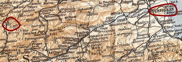
1. Perpignan to Ax-les-Thermes
If the quotation in our introduction sounds
a little pompous - it is: nevertheless it does represent our attitude as
we left Perpignan one warm Sunday morning in early June, and to underline
this we can state categorically that we had no intention of staying in
Ax-les-Thermes when we set out.
We had arrived in Perpignan quite late the previous evening but did find
time to wander around the Palais des Rois de Majorque with its stark blank
fortified walls before dropping down some narrow dusty streets to settle
into a bar selling an impressive range of chilled Belgian beers. Here we
hatched a plan for the following day: to drive up the Tet valley as far as
Thues and take a stroll up the Caranca Gorge in an attempt to gauge our
fitness for something a little more strenuous later in the week.
Depending on time available we would then decide where to stay the
night.
The lower reaches of the Tet passed by
quickly - the mountains in the distance drawing us in. We stopped in
Prades to buy some provisions for lunch before pressing on into the upper
Tet valley. As the road narrowed Antony decided that the French drivers
coming in the opposite direction were trying to kill him. To compensate
for this he drove so close to the right that I thought he may be trying to
kill me. In fact it was a problem both of us experienced - accustomed to
right hand drive cars, we just weren't used to vehicles passing so close to us
on our left. It took until about day six to acclimatise.
We parked up in Thues at the foot of the dramatic Caranca
Gorge, a narrow opening carved into a huge block of rock on the north
west side of the Canigou massif. It is initially quite difficult gauge the
scale of the defile as the 'Train Jaune', which climbs the Tet valley
alongside the road, passes right in front of the mouth of the gorge on a
bridge some 15 metres up in the air. Once you pass under this, the path
follows the river in an overhang under the rock face which makes looking
up pretty tricky. It takes about 45 minutes and a steep climb before you
can finally make any sense of where you are. From here and with the river
over 100 metres below, the path is cut out of the rock face - and with the
sense that you are about to bang your head into the rough hewn rock
overhead the presence of a steel guide rope bolted to the wall is most
welcome.
When the path next meets up with the river, it is at a series of catwalks,
ladders and rope bridges which enable you to climb almost directly up the
river bed. The sound of crashing water and lush vegetation put us very
much in mind of John Boorman's "Deliverance", except that you
were more likely to meet your end attempting to pass a fully laden
backpacker on a narrow catwalk than by some mysterious backwoodsman
slitting your throat! We met a constant stream of walkers heading down the
gorge and at times the traffic jams caused were only second in irritation
to having to deliver a cheery 'Bonjour!' in response to every single
person that we passed.
The higher we climbed, the less dramatic the gorge became. In the higher
reaches dense woodland gave way to a wide mountain valley. Sadly time didn't
permit us to make it quite as far as the Refuge de Caranca before we
turned back but the descent proved equally as spectacular with the late
afternoon sun casting a different light and the extent of the chasm at the
lower end becoming far easier to discern.
We had been out walking for about seven hours including our lunch stop so
a few moments with a cold beer were strictly necessary: we used the time
to plan our next move. We decided on Tarascon, home of prehistoric cave
painting and the Ariege river. Continuing up the Tet valley as far a the
imposing garrison town of Mont
Louis, we ignored all the road signs pointing to Andorra and turned west.
Surprisingly the twists and turns of the Tet valley gave way to a wide
plateau - a bleak plain with a single road running across it. Not easy to
lose your way you might think but it was here that the inadequacies of our
IGN map became apparent.
We had acquired this map at Stanstead Airport just before leaving England
because Antony, who I had trusted with my reliable Michelin Map, had left
it in a box in his house. This map was rather lacking in detail but showed
a simple route with just one left turn needed between Mont Louis and
Ax-Les-Thermes (hereinafter referred to as 'Ax'). Finding ourselves
halfway to Quillan we turned to the Rough Guide which showed an alarming
number of roads in their map of the area. Sometime later I found an even
more detailed map two pages further on. Still, Antony got a lot of
practice in taking hairpin bends and the brakes had a chance to bed in.
When we finally crossed the freezing Col de Pailheres
somewhat later than planned, we decided to stay in Ax instead.
After finding a hotel, we found that the food options were limited (one
restauranteur
replied to my polite enquiry for a table for two by shouting "Non!
C'est impossible!!"). We settled into the one restaurant that would
have us and ate a much overdue three course meal before finishing the day
by soaking our feet in the highly civilised Ax public
thermal foot bath.
next: 2. Ax-les-Thermes
to Bagneres-de-Luchon
|